


CORTIJO OF hornillo
Once again we headed toward the town of Sierra Güejar to explore one of the most beautiful routes that run through the Hill of San Juan, bound and main point of the stove in the farmhouse. This way, you can start on several fronts: falling from the nose or Depth of the bowl, along the Carretera de Sierra Nevada Hotel descending to the Duke's turn to the right hand lane going towards the old workings and mines Serpentina in the middle of Barranco de San Juan, and for us today, and we prefer it in a circular, taking back the Vereda de la Estrella, which by the way today was a strong smell and taste of spring. So much so that even a simple thistle would not a little to teach us.
For this we turn once again towards the Barranco de San Juan (1,180 m.), access to which I have mentioned in previous routes such as the Guarnón, that of the Serpentine and the Forest Refuge Calvary. Located
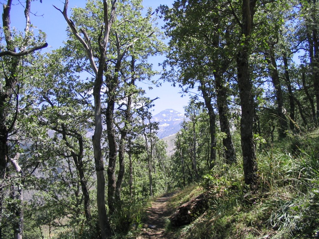
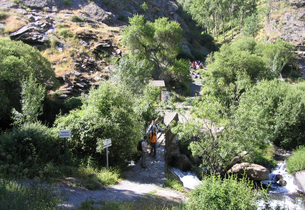
and the junction of the rivers San Juan and Genil, ie near the ravine and place where we parked the car next to the existing picnic there, cross the wooden bridge that crosses the other side, the left from this important tributary of the Guadalquivir and starting point of the Vereda de la Estrella. First steps we take in a sharp rise, about 200 meters, for starters legs, and then comfortably and move and by what we call a false flat on the rest of the itinerary of the same.
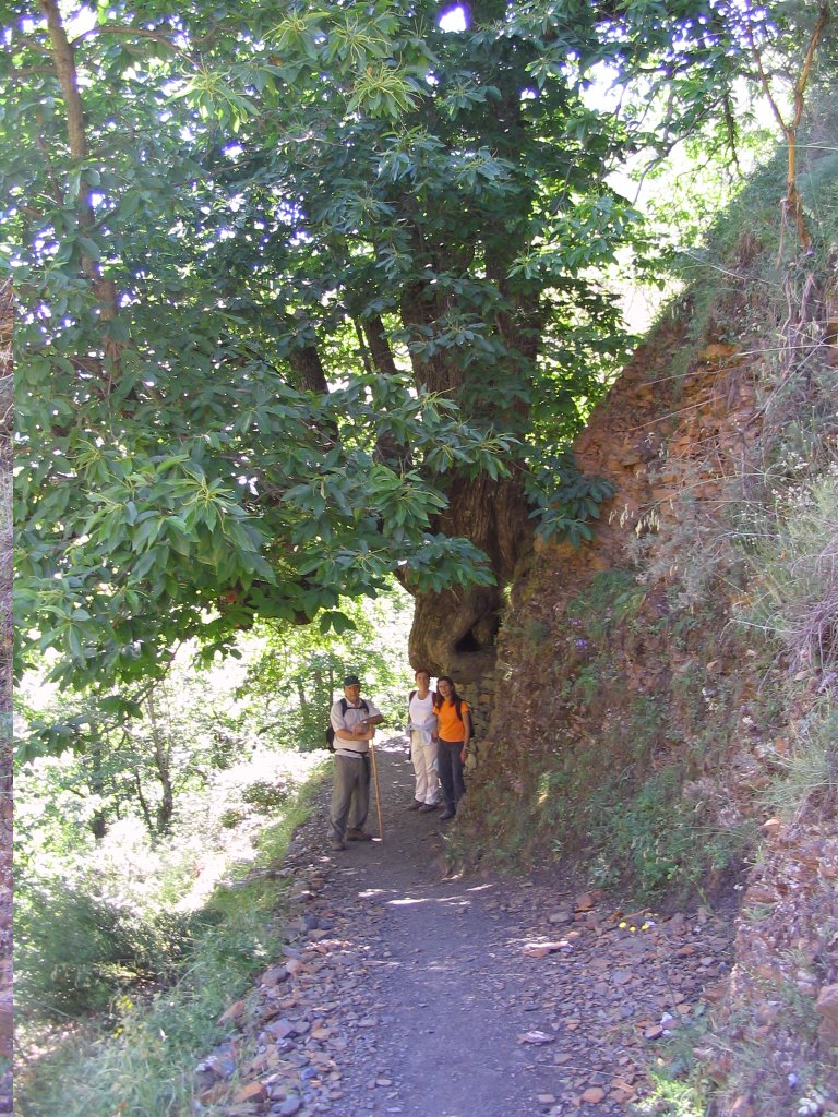
a half hour, we meet with the centenary chestnut known as "Grandpa " to honor him with the usual friendly greeting. An hour about the diversion of Vadillo. In one hour and forty-five minutes with the ruins of the tester Mina. From these, a detour to the right and, soon, one more. It does not matter to take one another, they both agree on their fate. This narrow path
ruthlessly attacked, a sack to understand and learn what goes one meter between levels of the good, the Loma de la Dehesa San Juan , so you have to take it with philosophy and good legs, because the gap to save is very important. At the peak of the route, about 756 meters or so.
I have to say the village is very little traffic and the time when we enter the first oak that comes to us we can easily lose because of the thick grass available (in the fall foliage), with consequent nuisance and loss of time involved in having to find it again. If this happens, and always trying not to lose altitude, we can take the option on the ground and ladeándonos to the right until una pequeña chorrera. A nuestra derecha observamos un gran roquedal y sobre él pasa la vereda perdida. Otra variante de atacada desde este punto al Cortijo del Hornillo y que hoy nosotros sufrimos como nuestra y nos llevamos puesta como muestra de la variante de las indagaciones es desviarse a la izquierda, con dirección hacia el Barranco del Guarnón, porque también existe otra vereda que hacia allí te lleva, para al final girar a la derecha y subir loma que te doma cada uno a su horma, para dirigirnos de nuevo hacia el robledad de la derecha. La causa, pues lo de siempre, la mala y/o peor, la falta de señalización a la que nos enfrentamos los usuarios, ya que la vereda se pierde por muchísimos momentos.
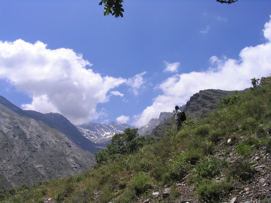
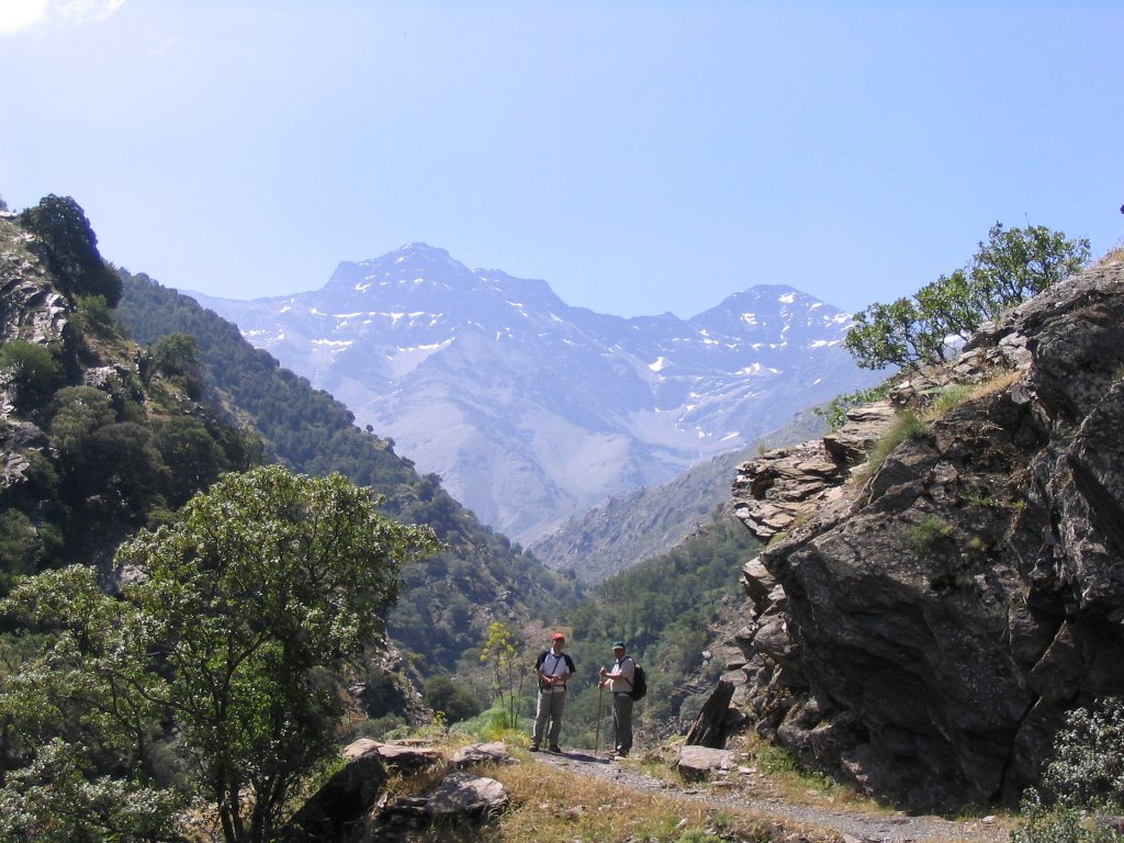
El caso es que, After about three hours from the start of the walk, we finally arrived at a beautiful green plateau that is home to some pens and some huts for livestock. This is the Cortijo del Stove (1838 m.) Here we make a stop for supplies for the best views of Sierra Nevada peaks and we have brought to our backs (if the route we would have done in the opposite direction we would head as impact.) Emphasizing, therefore, left to right, Vacares The Strut, The Citadel, The Depth of Seven Lakes, Mulhacén, Bowls and Depth of the Caldera looming, all as the hand and a stone's throw from the camera. On the right, and if we approach the Barranco del Guarnón, we can see one of the males and the Pico del Veleta. Directly opposite note, acknowledging the naked eye by its whitewashed facade, the Forest Refuge Calvary (known popularly as La Cucaracha). Above, on the horizon, the hill of the Cradle of the quarter, leading to the Sinks of the Queen and unfortunately this year we lost the ticket to visit them as God commands (with the right proportions of snow and water) . The reason, the intense heat of May that we were caught once. But what can we do, next year we will walk more savvy SDQ.
renew the march, after about three quarters of an hour of great break, and by soft cross descent the last gasps of oak, with its distinctive leaves lobe, called the bowls of and being also the highest in the Iberian Peninsula. The back trail runs parallel to the Vereda de la Estrella, but with the proviso that it does about 500 feet or so above it and is also weaving in a gentle and easy descent and crossing small ditches, streams and frills . Peaking of slope on the 1,936 m.
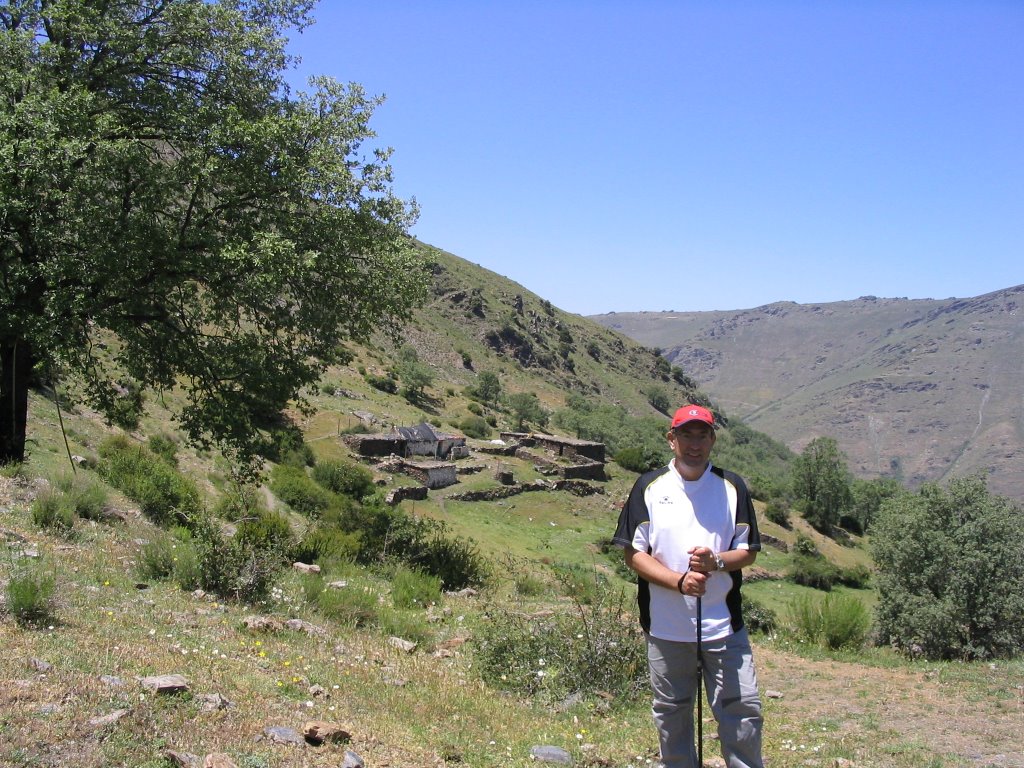
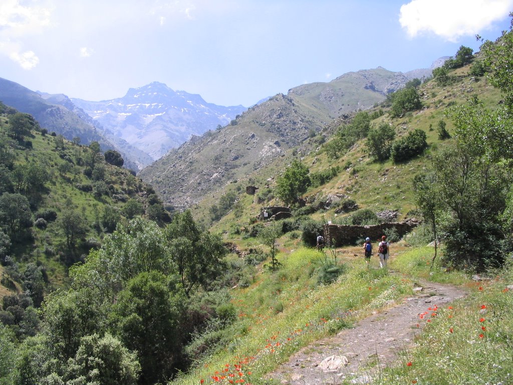
Soon our right, if you descend downhill to an elevation level between 1,700 and 1,600 meters, we would find the Old Cabin Cortijo and where Part one of the most beautiful and frills that go through the Vereda de la Estrella. Later we passed a beautiful place called Mesa Meadows Haza, with beautiful views of the cliffs of San Francisco, to our left and the background, and place very close to the Morra. After taking some snapshots we continued the march to, then make a brief stop at another large square in which there is some pens and several groups of rocks, is the Cortijo del Hoyo (1,664 m.)
Once again we headed toward the town of Sierra Güejar to explore one of the most beautiful routes that run through the Hill of San Juan, bound and main point of the stove in the farmhouse. This way, you can start on several fronts: falling from the nose or Depth of the bowl, along the Carretera de Sierra Nevada Hotel descending to the Duke's turn to the right hand lane going towards the old workings and mines Serpentina in the middle of Barranco de San Juan, and for us today, and we prefer it in a circular, taking back the Vereda de la Estrella, which by the way today was a strong smell and taste of spring. So much so that even a simple thistle would not a little to teach us.
For this we turn once again towards the Barranco de San Juan (1,180 m.), access to which I have mentioned in previous routes such as the Guarnón, that of the Serpentine and the Forest Refuge Calvary. Located
and the junction of the rivers San Juan and Genil, ie near the ravine and place where we parked the car next to the existing picnic there, cross the wooden bridge that crosses the other side, the left from this important tributary of the Guadalquivir and starting point of the Vereda de la Estrella. First steps we take in a sharp rise, about 200 meters, for starters legs, and then comfortably and move and by what we call a false flat on the rest of the itinerary of the same.
a half hour, we meet with the centenary chestnut known as "Grandpa " to honor him with the usual friendly greeting. An hour about the diversion of Vadillo. In one hour and forty-five minutes with the ruins of the tester Mina. From these, a detour to the right and, soon, one more. It does not matter to take one another, they both agree on their fate. This narrow path
ruthlessly attacked, a sack to understand and learn what goes one meter between levels of the good, the Loma de la Dehesa San Juan , so you have to take it with philosophy and good legs, because the gap to save is very important. At the peak of the route, about 756 meters or so.
I have to say the village is very little traffic and the time when we enter the first oak that comes to us we can easily lose because of the thick grass available (in the fall foliage), with consequent nuisance and loss of time involved in having to find it again. If this happens, and always trying not to lose altitude, we can take the option on the ground and ladeándonos to the right until una pequeña chorrera. A nuestra derecha observamos un gran roquedal y sobre él pasa la vereda perdida. Otra variante de atacada desde este punto al Cortijo del Hornillo y que hoy nosotros sufrimos como nuestra y nos llevamos puesta como muestra de la variante de las indagaciones es desviarse a la izquierda, con dirección hacia el Barranco del Guarnón, porque también existe otra vereda que hacia allí te lleva, para al final girar a la derecha y subir loma que te doma cada uno a su horma, para dirigirnos de nuevo hacia el robledad de la derecha. La causa, pues lo de siempre, la mala y/o peor, la falta de señalización a la que nos enfrentamos los usuarios, ya que la vereda se pierde por muchísimos momentos.
El caso es que, After about three hours from the start of the walk, we finally arrived at a beautiful green plateau that is home to some pens and some huts for livestock. This is the Cortijo del Stove (1838 m.) Here we make a stop for supplies for the best views of Sierra Nevada peaks and we have brought to our backs (if the route we would have done in the opposite direction we would head as impact.) Emphasizing, therefore, left to right, Vacares The Strut, The Citadel, The Depth of Seven Lakes, Mulhacén, Bowls and Depth of the Caldera looming, all as the hand and a stone's throw from the camera. On the right, and if we approach the Barranco del Guarnón, we can see one of the males and the Pico del Veleta. Directly opposite note, acknowledging the naked eye by its whitewashed facade, the Forest Refuge Calvary (known popularly as La Cucaracha). Above, on the horizon, the hill of the Cradle of the quarter, leading to the Sinks of the Queen and unfortunately this year we lost the ticket to visit them as God commands (with the right proportions of snow and water) . The reason, the intense heat of May that we were caught once. But what can we do, next year we will walk more savvy SDQ.
renew the march, after about three quarters of an hour of great break, and by soft cross descent the last gasps of oak, with its distinctive leaves lobe, called the bowls of and being also the highest in the Iberian Peninsula. The back trail runs parallel to the Vereda de la Estrella, but with the proviso that it does about 500 feet or so above it and is also weaving in a gentle and easy descent and crossing small ditches, streams and frills . Peaking of slope on the 1,936 m.
Soon our right, if you descend downhill to an elevation level between 1,700 and 1,600 meters, we would find the Old Cabin Cortijo and where Part one of the most beautiful and frills that go through the Vereda de la Estrella. Later we passed a beautiful place called Mesa Meadows Haza, with beautiful views of the cliffs of San Francisco, to our left and the background, and place very close to the Morra. After taking some snapshots we continued the march to, then make a brief stop at another large square in which there is some pens and several groups of rocks, is the Cortijo del Hoyo (1,664 m.)
the road, from a rock surrounded by large squares, marked vegetation and a panoramic view of the town of Sierra Güejar (framed precisely between the trunks of trees), now falls sharply divided into many narrow paths, surrounded by thousands of wild lilies "to sfódelo" but ultimately all converge on one and the same dirt track. We descend by turning it clockwise (to the left died in an old quarry mineral extraction). Soon we find a bifurcation: the right way we would fall to Cortijo de la Hortichuela and below, again, at the beginning of the Vereda de la Estrella, but we opted to take the left. We continued walking and we ran over the remains of the old workings of the Serpentine Mines and on a large grate on the floor, is to prevent the passage of livestock. Down there, on our right, and we see the San Juan bolted to loosen their forces in a dam or dike where there are also some remains of buildings of the old mines of Serpentine, to continue his journey and become a waterfall ravine.
And to end and taking the path that leaves us on our right and signposted Vegueta Snail, straight and free fall towards the confluence of the San Juan River Genil and high in the picnic area from the start; point where we parked the car, to drink up the source of birth that falls in the vicinity and as well put on your label "non-chlorinated water" but we know the sky and sea without so. A place to sit with the sound of roaring water and have a snack, or they're needed.
As always some photos to remember. And that moment of the flora that accompanied us, noting today an exclusive endemism of the beautiful Sierra Nevada Foxglove "Digitalis purpurea " - variant- nevadensis (escrofulariácea herb, flower cluster earrings terminal, shaped corolla thimble, and whose leaves contain digitalis , a very poisonous glucoside, but at doses lower than 1 mg. is used as a heart tonic) and those poppies of the field as blood shooting renews and drag these walks.
-Route: Highway Bypass Granada - Ronda Sur - Sierra Güejar Departure - Barranco de San Juan by car * Star Trail-Mines of the testers - Cortijo del Stove - Haza Mesa - Cortijo del Hoyo - Mines Serpentine - Vegueta of Caracol - Barranco de San Juan.
-Number of participants: 4
-Difficulty: Medium / Low
-Length: 7 1 / 2 hours approx.
-Water: In many parts of the route.
0 comments:
Post a Comment