


GREEN RIVER
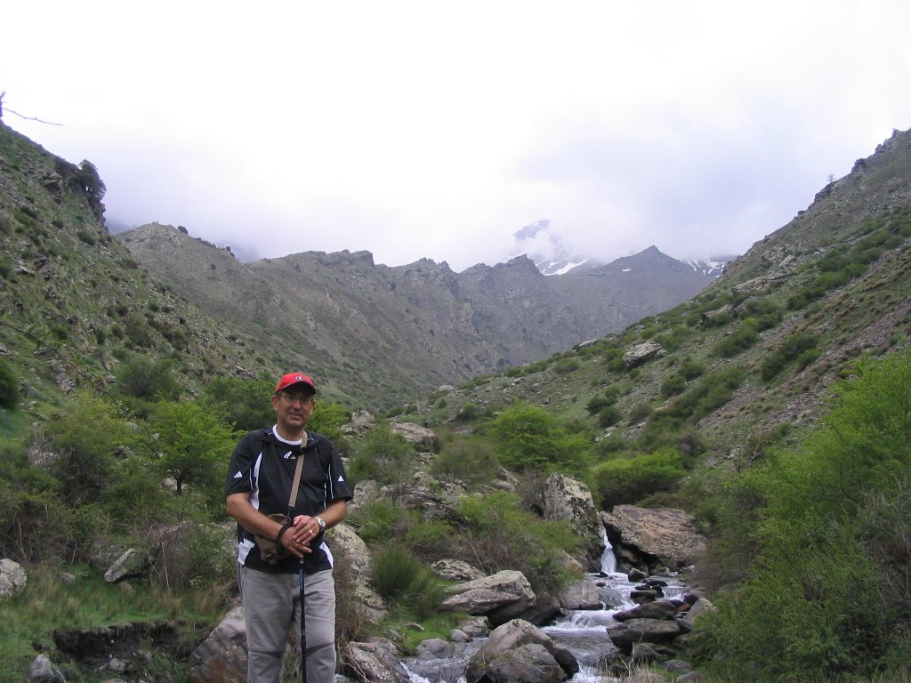
Like today woke heat pressing in Granada, and at 9 am we had 21 º, we decided that if he had to sweat shirts, then what better remember it getting wet in the crystal waters of the rivers Chorreras and Green , all within the Parque Natural de las Sierras de Tejeda , Almijara and Alhama. Again we
four, Mary Angeles, Antonio, Nieves and this humble commentator and photographer. Because yes, the camera today there was no one take it away, although some oversight for that, what ever happens ... as dame, as you always do for paparachi! Total
, back on the path of travel, the itinerary of today, the Waterfalls and Canyons of the Rio Verde , presents some difficulties for its innumerable ups and downs and that no other remedy adapted to the configuration of field. But not to worry because everything is very well marked and protected with guardrails (steps that seem to jump into the vacuum.) So that was it, of admire splendid waterfalls, through narrow canyons, touching the bottom eye natural pools of crystalline water, soft drink, peek into the void through beautiful viewpoints, and above all, surrounded by the nature that always awaits us and we attached.
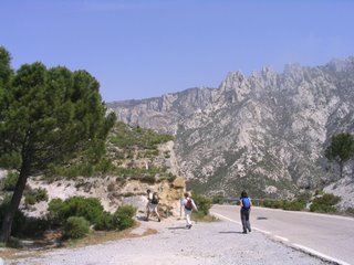
headed towards it today by the Beltway with Granada to Motril to exit Padul-Otívar and follow the highway A-4050 known as " Carretera de la Cabra" and that leads to Almuñecar.
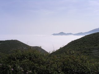
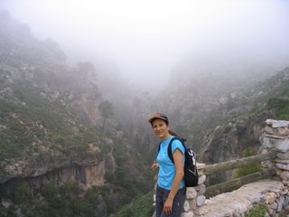
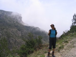
Indicate that the start of this road is currently under construction and should be be an interminable eight miles at least between the dust and fog. And to make matters worse, today, as the real (a fog I mean) we partner made almost the whole trip through the ravines. But hey, these are things of nature and also appreciates when Lorenzo burns. Total
that back in the 31.2 kilometer of the road, once past the Llanos de Lopera and the only tunnel crossing the road, and already on the road (2.5 km. After the tunnel) in the expansion right there, right where the information panel on the path Green River, is where it really gets good.
As aclararación and advice of this beautiful place, we have brought two cars today in order to leave one here and one in the final point in the so-called Iron Bridge. To get there we must continue down the road a bit more, once achieved km 42.5 (about 7.5 miles past the old gas station and gazebo, to take a detour to the right, and it's nothing more and nothing less than a private lane of land about 5 miles long and a fee of 4 Euros per person and car that saves you from having it up when we get to that Iron Bridge. And the truth is that it appreciates the spill on the ground. As would also be acceptable that the Owners of Cázulas (Owners of the box apparently private), at least give him a "coat of paint" to track with what they earn (diligence that gently suggest to the "blockbuster", the output in order to make it available their heads)
So, turning the four in the second car, we went up the road and we parked at the starting point of the itinerary above. We began our journey
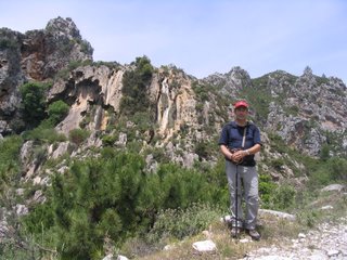
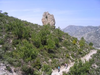
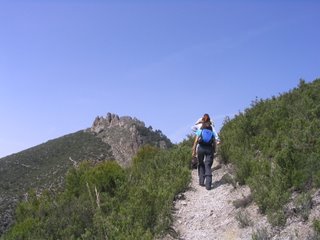
on foot, walking as the law of demand in the Chortales Collado, where a few meters up the trail starts by the Cerro de Martos or Facar Hill will soon be off to the right into a steep descent. If we look to the Northeast see a bill imposing cliffs of limestone called " The Fish Poyos" , one of the steps used in antiquity to transport horses fish from the coast to Granada. The trail winds its initial stage and runs through a landscape shaped by fire, water, and wind and passes through pine forests and young pine pinaster Carrasco, oak, some gall in the shadows, juniper, madrone, amelancher, daphne, Halimium , rosemary, gorse and numerous species of Labiatae aromatic as Satureja, lavender and others. All this accompanied by stunning panoramic views that allow us to glimpse from north to south, Pico de Lopera (with guardhouse fire), El Cerro Cabañeros and already on the boundary with the province of Malaga Navachica Peak with its 1,831 m is the highest in the south of the park. The area we cover is geologically formed by decomposed limestone, dolomite, in which the effects of erosion caused by weather, are very pronounced.
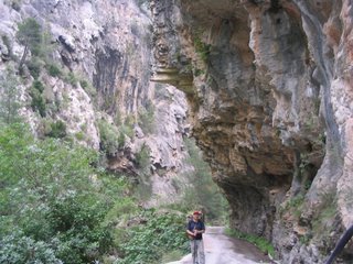
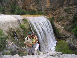
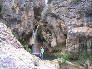
As we go down, the gap is increasing, except sometimes with high steps, even with handrails handrails to help further the sense of security and traffic. We see here and the first waterfall. is petrified tree bark or Chorreras of Palos that we almost like them to see its outline in the rock and crystalline pool water as if to collect his bones.
To the right of the waterfall there is a cave, with some samples of stalactites and stalagmites still alive and kicking. From this point begins the descent to the Arroyo de los Chortales , which patearemos on his right.
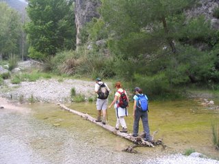
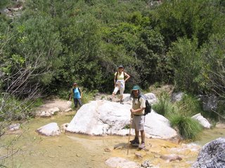
few hundred meters went down to the bed of the stream to cross and go far left bank. Later, the trail connects with the rail Cabrerizas , which take up to a junction with the trail. The track crosses the river and a few meters away is the source of Cabrerizas , where you can freshen up the words.
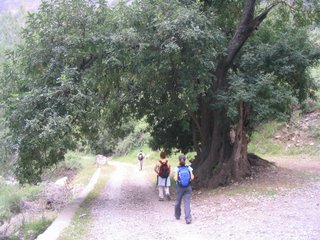
We returned to the junction and continue along the sidewalk, watching as the flora changes completely. Now there are many ferns, palms, willows, fig trees and flora so that always accompanies us.
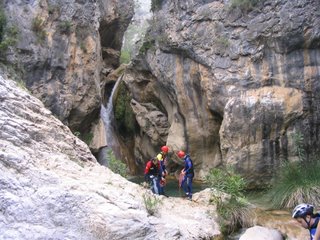
crossing the stream several times, highlighting their pools and clear water. After a slight rise on our right rise the world's greatest waterfalls Funes. From here begins the practice of canyoning for fans of that subject.
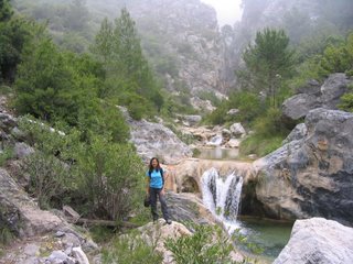
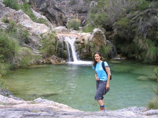
After continuing now in decline came to a plain surrounded by greenery and we have to pass through a "colaero" which brings us back to the river to cross with relative ease and put us on the basis of a path with a sharp rise, to save some of the guns of the stream. The path widens and opens to cap-shaped track, where we see huge rock falls. Soon we spotted the Barranco de La Topera , and on whose right bank to our left, we zigzagged down the path until you get back into the riverbed. To our left we have another prize. A large pool of clear water and green and collects water from a huge waterfall coming down romping through a narrow gorge carved by the hand of nature. Here we take a break on the water for refreshment, refresh, empty backpacks and our words nearby.
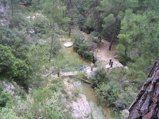
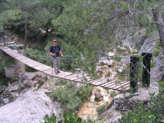
From here we marched interchangeably by either side of the river, crossing several suspension bridges (we have had up to four) and authorized to four persons. We also passed along to various viewpoints and worthwhile peek. When the last suspension bridge, and the road becomes almost flat with large poplars until the end of the river Chorreras you receive for your right to Birth River, giving rise to the famous Green River . This is known as conjugal union Junta de los Rios, and we have no bridges to cross and oppose the difficulty depending on the season, the flow water. Today they were neither for nor to drown nadarlos documented in the minutes of the word.
a few meters to our left we see a beautiful waterfall and the official taking of water into the town of Otívar.
We continue walking on the right bank of the river, watching a magnificent specimen of carob, enormous pits sometimes embroidered with curious limestone formations that rise on either side of the gorge. In the end, we reached the second car and we parked on this side of Iron Bridge . End
So, turning the four in the second car, we went up the road and we parked at the starting point of the itinerary above. We began our journey
on foot, walking as the law of demand in the Chortales Collado, where a few meters up the trail starts by the Cerro de Martos or Facar Hill will soon be off to the right into a steep descent. If we look to the Northeast see a bill imposing cliffs of limestone called " The Fish Poyos" , one of the steps used in antiquity to transport horses fish from the coast to Granada. The trail winds its initial stage and runs through a landscape shaped by fire, water, and wind and passes through pine forests and young pine pinaster Carrasco, oak, some gall in the shadows, juniper, madrone, amelancher, daphne, Halimium , rosemary, gorse and numerous species of Labiatae aromatic as Satureja, lavender and others. All this accompanied by stunning panoramic views that allow us to glimpse from north to south, Pico de Lopera (with guardhouse fire), El Cerro Cabañeros and already on the boundary with the province of Malaga Navachica Peak with its 1,831 m is the highest in the south of the park. The area we cover is geologically formed by decomposed limestone, dolomite, in which the effects of erosion caused by weather, are very pronounced.
As we go down, the gap is increasing, except sometimes with high steps, even with handrails handrails to help further the sense of security and traffic. We see here and the first waterfall. is petrified tree bark or Chorreras of Palos that we almost like them to see its outline in the rock and crystalline pool water as if to collect his bones.
To the right of the waterfall there is a cave, with some samples of stalactites and stalagmites still alive and kicking. From this point begins the descent to the Arroyo de los Chortales , which patearemos on his right.
few hundred meters went down to the bed of the stream to cross and go far left bank. Later, the trail connects with the rail Cabrerizas , which take up to a junction with the trail. The track crosses the river and a few meters away is the source of Cabrerizas , where you can freshen up the words.
We returned to the junction and continue along the sidewalk, watching as the flora changes completely. Now there are many ferns, palms, willows, fig trees and flora so that always accompanies us.
crossing the stream several times, highlighting their pools and clear water. After a slight rise on our right rise the world's greatest waterfalls Funes. From here begins the practice of canyoning for fans of that subject.
After continuing now in decline came to a plain surrounded by greenery and we have to pass through a "colaero" which brings us back to the river to cross with relative ease and put us on the basis of a path with a sharp rise, to save some of the guns of the stream. The path widens and opens to cap-shaped track, where we see huge rock falls. Soon we spotted the Barranco de La Topera , and on whose right bank to our left, we zigzagged down the path until you get back into the riverbed. To our left we have another prize. A large pool of clear water and green and collects water from a huge waterfall coming down romping through a narrow gorge carved by the hand of nature. Here we take a break on the water for refreshment, refresh, empty backpacks and our words nearby.
From here we marched interchangeably by either side of the river, crossing several suspension bridges (we have had up to four) and authorized to four persons. We also passed along to various viewpoints and worthwhile peek. When the last suspension bridge, and the road becomes almost flat with large poplars until the end of the river Chorreras you receive for your right to Birth River, giving rise to the famous Green River . This is known as conjugal union Junta de los Rios, and we have no bridges to cross and oppose the difficulty depending on the season, the flow water. Today they were neither for nor to drown nadarlos documented in the minutes of the word.
a few meters to our left we see a beautiful waterfall and the official taking of water into the town of Otívar.
We continue walking on the right bank of the river, watching a magnificent specimen of carob, enormous pits sometimes embroidered with curious limestone formations that rise on either side of the gorge. In the end, we reached the second car and we parked on this side of Iron Bridge . End
water and ride (walk clear that we still had the tortuous drive back). But it was a matter of climbing the 5 Lane miles to heart, because the legs are grateful and views from the lane, the truth is that not much, just saved the lush vegetation in bloom at this time, predominantly yellow and not suitable for bullfighters hives and a city of many that exist in these lands. The trip is worth it, really, at least here in spring, and once a year does not hurt, would have to do it.
End of comment and the passage of travelers. As usual some pictures to count the memory.
*
-Route: Granada, Km.31, 2 of the Highway A-4050 * "Goat Road" - by car (leaving a second car at the end of the journey linear path (Iron Bridge)
-Number of participants: 4
-Difficulty: Medium
-Duration: 5 hours
-Water: Source of Cabrerizas
*
-Route: Granada, Km.31, 2 of the Highway A-4050 * "Goat Road" - by car (leaving a second car at the end of the journey linear path (Iron Bridge)
-Number of participants: 4
-Difficulty: Medium
-Duration: 5 hours
-Water: Source of Cabrerizas
0 comments:
Post a Comment