


BRIDGE ON
ALPUJARRA
ALPUJARRA
Day 13-Oct-2006
That was done! On this bridge that was left of Pilar new Maria Angeles, Antonio, Nieves and this humble commentator adventurer and photographer to direct our steps towards our beloved Alpujarras and to appear at the balcony so natural, full of blue, green and white and without handrails.
To do this go out from Granada on Friday, 13 on the 5 pm, with room reserved in advance, because the bridge is advised, and the dreams included ahead towards the beautiful, white and hospitality in Capileira ( Capillaria Latin: hair, alluding to the fact that this county is the highest in the Barranco del Poqueira) . Upon reaching her, call Jose Ramon, old friend and fellow adventures of my cousin Antonio and has a home in Bubión (Latin bovium: field of oxen). So there we are invited to plan and discuss the route they would take the next day. Thanks, Jose Ramon y Maria Victoria, thence by the hospitality given away.
Day 14-Oct-2006
descended on foot, about nine in the morning from Capileira (1,436 m.) to Bubión (1,300 m.), where Jose Ramon and was waiting for us to start initiated by the first installment, which opened in the GR-7 in these places and going, and keep going, from the town of Granada Bubión a Pitre.
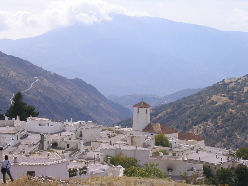
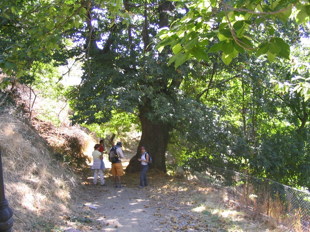
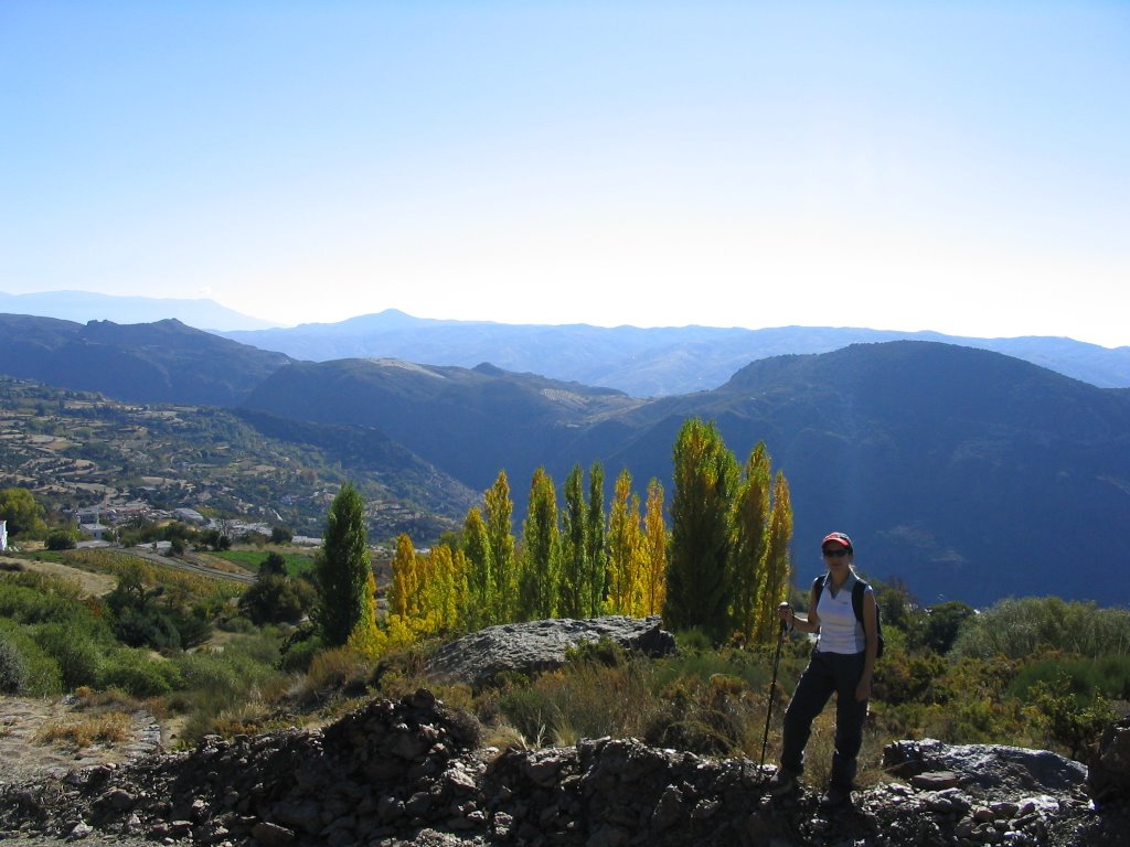
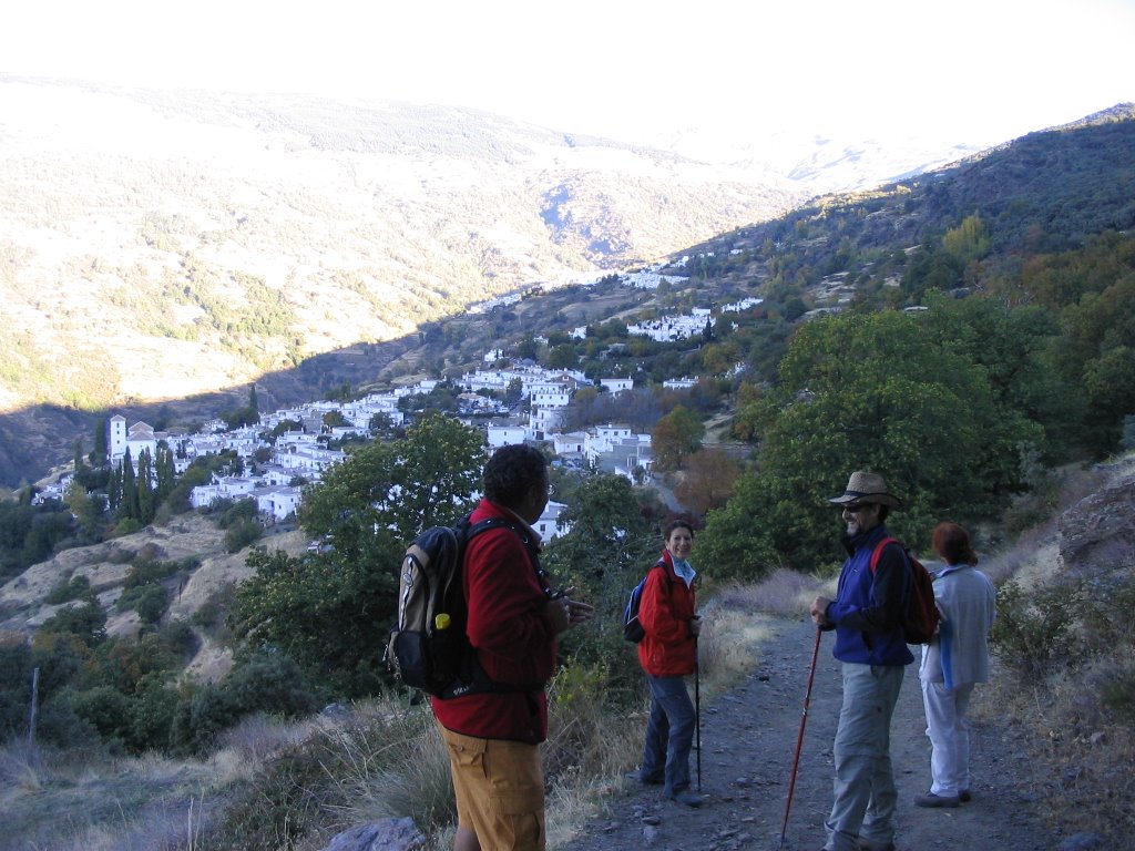
We went first, just a short walk and surrounded by Centennial Castañar of Bubión to incorporate, after vacuuming and rinsing eyes with these magnificent specimens of chestnut, and the trail clearly marked with its characteristic horizontal marks and painted in white and red and described as GR-7 - E-4 , up with toward the sky, and never better, to the Angel Pena, with a short climb and a stop on its very summit in the air. From here you can see, even the coastal town of Salobreña and took some great snapshots of Pampaneira (which the sun had not yet awakened, and which also comes from the Latin word, Pampinarium: as a place with many branches or land of vineyards) of Bubión, Capileira and the high peaks of Sierra Nevada (Tajos of the Virgin - with its built Capileira Fraile - Veleta, Los Machos, Rio Scrapes Dry and Depth of Caldera).
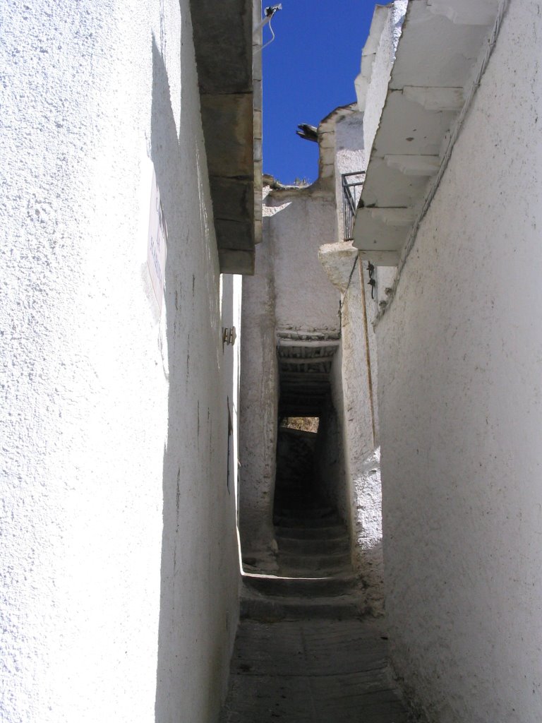
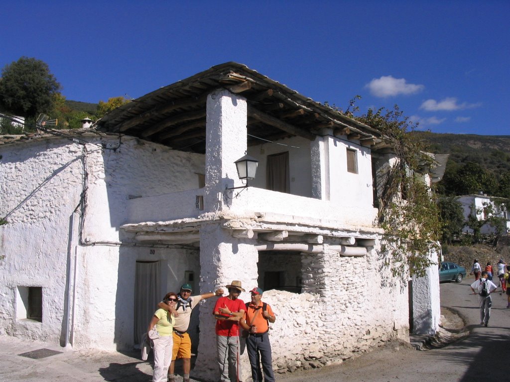
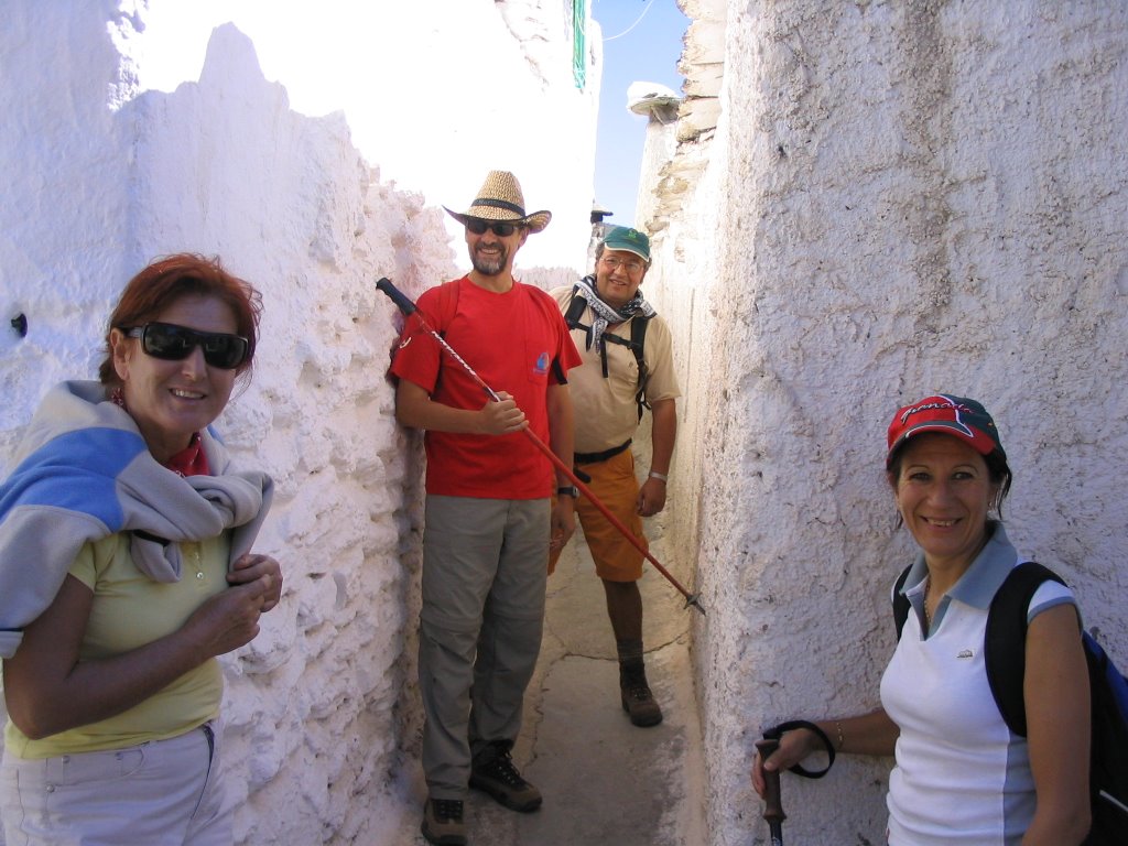
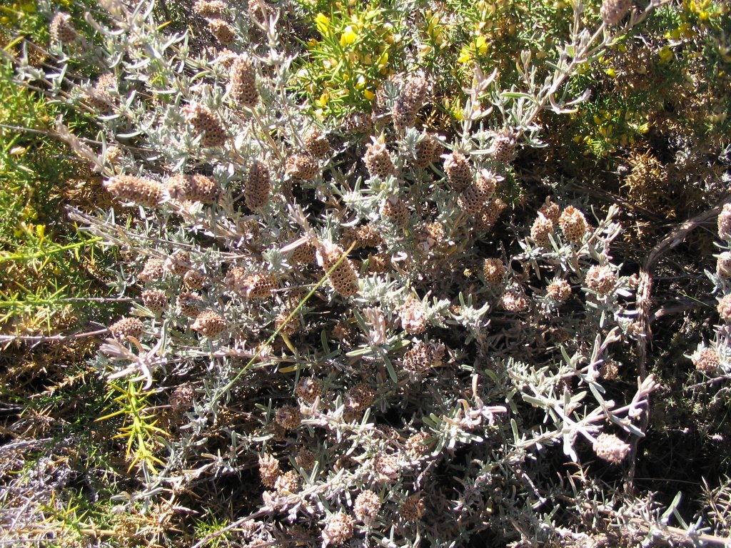
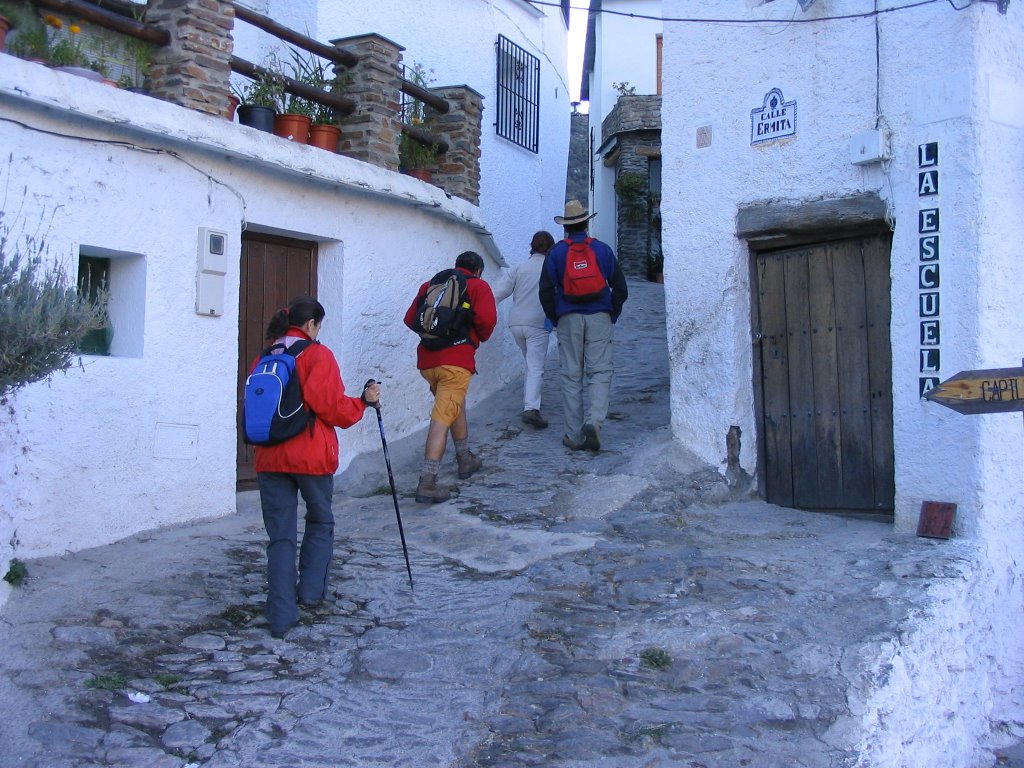
continue our march towards Pitres Taha crossing the headwaters of Barranco de la Sangre, accompanied at all the route of the road for a variety of lavender bushes (although pouring dry but the smell still so special to our steps) to first visit the pretty little town of Capilerilla where we discover that a street was not wider than our sticks. A neighbor told us it was the Gran Via and as such we accept it and smiling. We also visited the house here that Fernando Colomo shot some scenes for his film "Al Sur de Granada" on the life of Gerald Brenan.
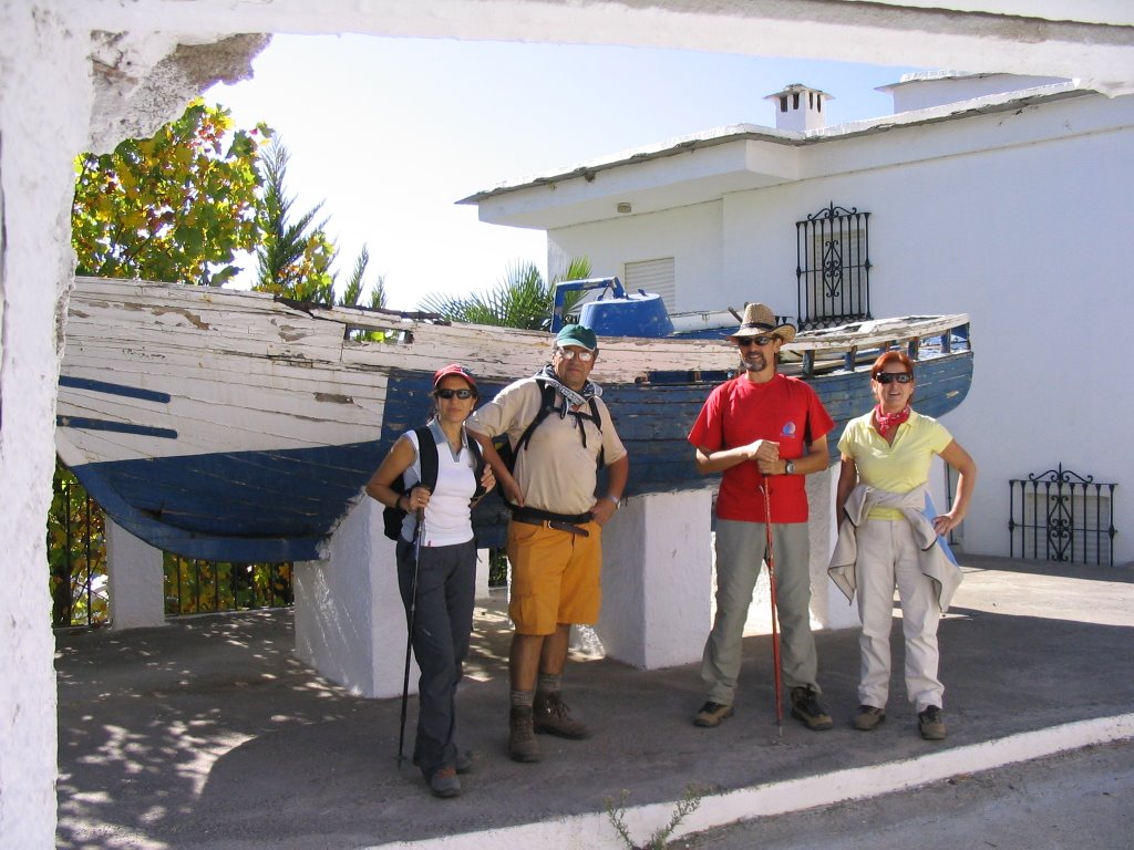
Capilerilla is the highest in the city center and its 1,400 m. altitude has the privilege of being the natural view of the entire Taha then fell to the beautiful town of Pitres to visit "the port", he promised that the mayor and consisting incrito and delivered on a plate for their inhabitants ... "Barbarians Pitres - What do you want? - Seaport? - Granted that you have" And indeed there was "Chanquete boat" on a town square, next to a bleached wash and to soak their bones.
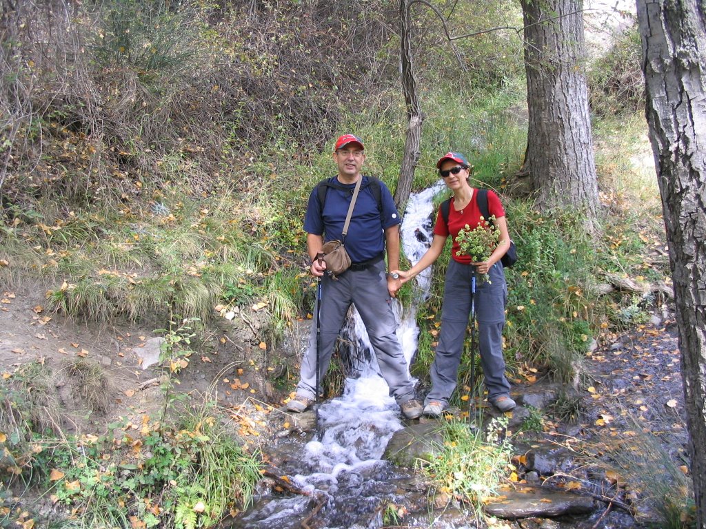
continue with our march down to get into Mecina , core of the old-Fondales Mecina, the second largest town of La Taha. We can highlight your church and urban layout perfectly adapted to the terrain. It also has a spring of bitter water. Here we make a brief stop for refreshments in the gorges. The Arabic word-Thahash-districts were governed by an executive officer (warden) and a spiritual leader (the alfaqui older) who divided the Alpujarras at the end of the Nazari dynasty (S. XV). There were twelve of Thahash covering throughout the Alpujarras, persisting Pitres only as of the date, but once all these people belonged to the Poqueyra Taha. We continued our march
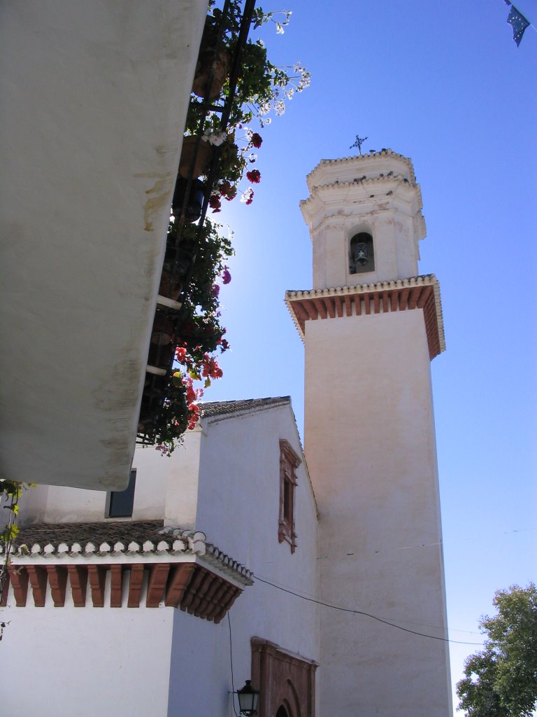
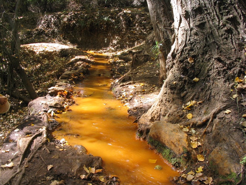
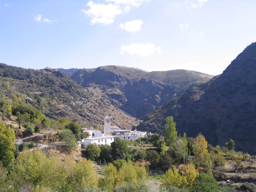
direction Ferreirola now, short for Ferreira, his name stands for "small iron ore mine." Almost hidden by its location between cliffs, only the church tower warns us of its presence. Noting further how the cemetery is attached to it, as tradition dictates. The quality of their sources are rare, the gas is unique in the Alpujarra, ferruginous waters because it combines with natural gas. Also this people preserve old ways from another era as former public bath and laundry. The beautiful
Ferreirola source, adorned with mosaics depicting various farming jobs on the vintage and located on the edge, we must and we take that high a few tastings of its waters. The note, since we already know that outstanding up. As the gases, of course ...! Gasearnos
After that much closer to our dry throats, now we take the GR-142 which leads to Busquistar to leave at the first turn that we left and that leads us now, costs and back up, the following village of Taha Atalbeitar or veterinary district "in Arabic. Is a Ferreirola annexed old, and together they formed a single municipality. Located in the village mosque Mozarabic Busquístar, Atalbeitar remains today one of the places that have preserved the quaintness of the building alpujarreña. Some of his sources have also ferruginous properties.
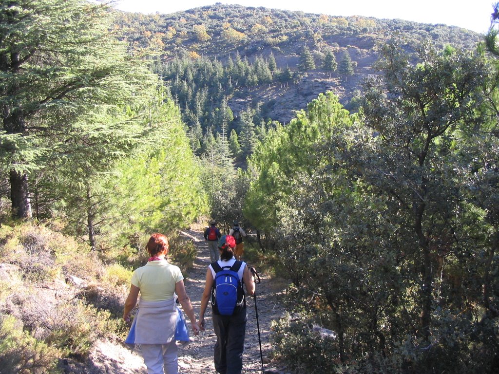
From Atalbeitar climb again, first by a stretch of paved road to incorporate us back to the GR-7. After crossing the Barranco Bermejo , end again in Pitres, leaving before our left an old shelter that is still in operation and that is so characteristic flora consists of ancient chestnut trees, oaks, poplars, oaks, rascaviejas, horehound ...
That was done! On this bridge that was left of Pilar new Maria Angeles, Antonio, Nieves and this humble commentator adventurer and photographer to direct our steps towards our beloved Alpujarras and to appear at the balcony so natural, full of blue, green and white and without handrails.
To do this go out from Granada on Friday, 13 on the 5 pm, with room reserved in advance, because the bridge is advised, and the dreams included ahead towards the beautiful, white and hospitality in Capileira ( Capillaria Latin: hair, alluding to the fact that this county is the highest in the Barranco del Poqueira) . Upon reaching her, call Jose Ramon, old friend and fellow adventures of my cousin Antonio and has a home in Bubión (Latin bovium: field of oxen). So there we are invited to plan and discuss the route they would take the next day. Thanks, Jose Ramon y Maria Victoria, thence by the hospitality given away.
Day 14-Oct-2006
descended on foot, about nine in the morning from Capileira (1,436 m.) to Bubión (1,300 m.), where Jose Ramon and was waiting for us to start initiated by the first installment, which opened in the GR-7 in these places and going, and keep going, from the town of Granada Bubión a Pitre.
We went first, just a short walk and surrounded by Centennial Castañar of Bubión to incorporate, after vacuuming and rinsing eyes with these magnificent specimens of chestnut, and the trail clearly marked with its characteristic horizontal marks and painted in white and red and described as GR-7 - E-4 , up with toward the sky, and never better, to the Angel Pena, with a short climb and a stop on its very summit in the air. From here you can see, even the coastal town of Salobreña and took some great snapshots of Pampaneira (which the sun had not yet awakened, and which also comes from the Latin word, Pampinarium: as a place with many branches or land of vineyards) of Bubión, Capileira and the high peaks of Sierra Nevada (Tajos of the Virgin - with its built Capileira Fraile - Veleta, Los Machos, Rio Scrapes Dry and Depth of Caldera).
continue our march towards Pitres Taha crossing the headwaters of Barranco de la Sangre, accompanied at all the route of the road for a variety of lavender bushes (although pouring dry but the smell still so special to our steps) to first visit the pretty little town of Capilerilla where we discover that a street was not wider than our sticks. A neighbor told us it was the Gran Via and as such we accept it and smiling. We also visited the house here that Fernando Colomo shot some scenes for his film "Al Sur de Granada" on the life of Gerald Brenan.
Capilerilla is the highest in the city center and its 1,400 m. altitude has the privilege of being the natural view of the entire Taha then fell to the beautiful town of Pitres to visit "the port", he promised that the mayor and consisting incrito and delivered on a plate for their inhabitants ... "Barbarians Pitres - What do you want? - Seaport? - Granted that you have" And indeed there was "Chanquete boat" on a town square, next to a bleached wash and to soak their bones.
continue with our march down to get into Mecina , core of the old-Fondales Mecina, the second largest town of La Taha. We can highlight your church and urban layout perfectly adapted to the terrain. It also has a spring of bitter water. Here we make a brief stop for refreshments in the gorges. The Arabic word-Thahash-districts were governed by an executive officer (warden) and a spiritual leader (the alfaqui older) who divided the Alpujarras at the end of the Nazari dynasty (S. XV). There were twelve of Thahash covering throughout the Alpujarras, persisting Pitres only as of the date, but once all these people belonged to the Poqueyra Taha. We continued our march
direction Ferreirola now, short for Ferreira, his name stands for "small iron ore mine." Almost hidden by its location between cliffs, only the church tower warns us of its presence. Noting further how the cemetery is attached to it, as tradition dictates. The quality of their sources are rare, the gas is unique in the Alpujarra, ferruginous waters because it combines with natural gas. Also this people preserve old ways from another era as former public bath and laundry. The beautiful
Ferreirola source, adorned with mosaics depicting various farming jobs on the vintage and located on the edge, we must and we take that high a few tastings of its waters. The note, since we already know that outstanding up. As the gases, of course ...! Gasearnos
After that much closer to our dry throats, now we take the GR-142 which leads to Busquistar to leave at the first turn that we left and that leads us now, costs and back up, the following village of Taha Atalbeitar or veterinary district "in Arabic. Is a Ferreirola annexed old, and together they formed a single municipality. Located in the village mosque Mozarabic Busquístar, Atalbeitar remains today one of the places that have preserved the quaintness of the building alpujarreña. Some of his sources have also ferruginous properties.
From Atalbeitar climb again, first by a stretch of paved road to incorporate us back to the GR-7. After crossing the Barranco Bermejo , end again in Pitres, leaving before our left an old shelter that is still in operation and that is so characteristic flora consists of ancient chestnut trees, oaks, poplars, oaks, rascaviejas, horehound ...
Here's wife joins Jose Ramon for lunch, and all together, in a typical restaurant in the Village Plaza, next to the church of San Roque, whose owner, and from some old "tub" and preserves , elegantly, in small rooms with rustic and reaching the most typical and original alpujarreña construction. Plated, taking all hats and caps, and opening for all purposes the mouths ...!
After the lunch, we bid farewell to Jose Ramon who leaves with his wife in the vehicle, and we four, the four riders on this bridge would shorten sadly, we headed back down the path brought us to this goal. So in Pitres to Capilerilla , and now we go again "sweating the Hump" between now and Capileira , following the lane highway to lead to the paved road and that is the Sierra de la Hoya del Portillo, Mulhacén and Vane, coming just at the point indicated and marked on a large rock of slate as "Cortijo Prado Toro." From here it's downhill just keep the 2 km of paved road to Capileira.
say is that I have invested in this circular motion about 5 hours (Capileira-Bubión-Capilerilla-Pitre Mecina-Ferreirola-Atalbeitar-Pitre), and 2 hours to return from Capilerilla-Capileira Pitre; total of 7 hours and "The Bridge" was paying off. Dinner and accommodation, sent here and the cool time was out.
Day October 15, 2006
The Cebadilla
The Gorge (Latin porca-Porcão : groove opens the ground to dismiss the water) very appropriate word to refer to this beautiful ravine at the foot of the highest peaks of the Iberian Peninsula should be, without doubt, a must for anyone who wants to know the Alpujarra. We start
Capileira about 10 h. in the morning, after breakfast, some coffee with donuts in another typical restaurant of the people to get into the Poqueira Valley, which in its middle and without high mountains, we discover the nakedness of the southern side highest peaks of the Iberian Peninsula.
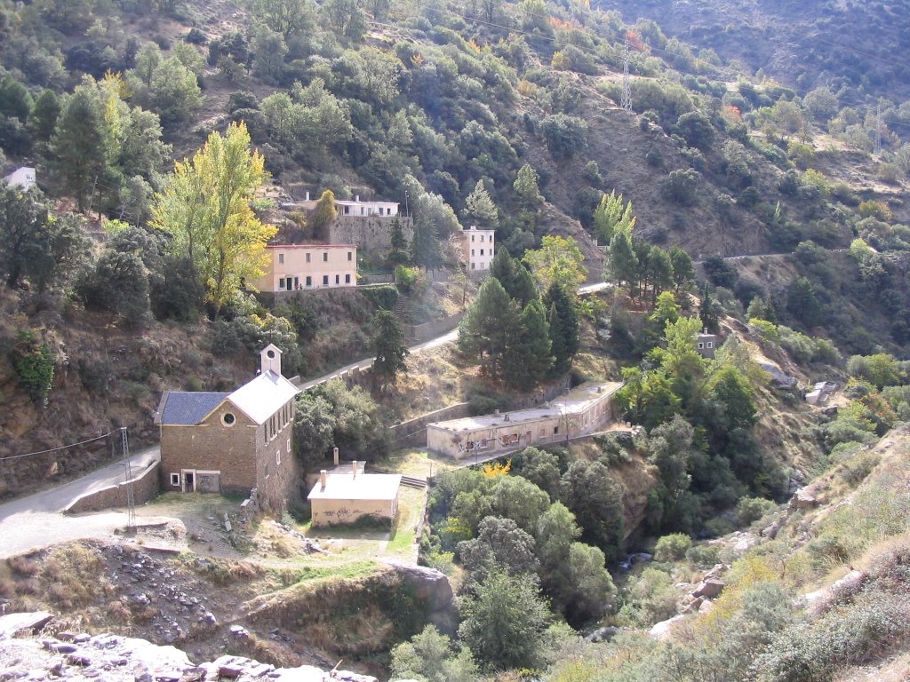
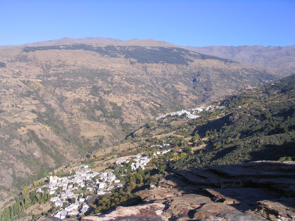
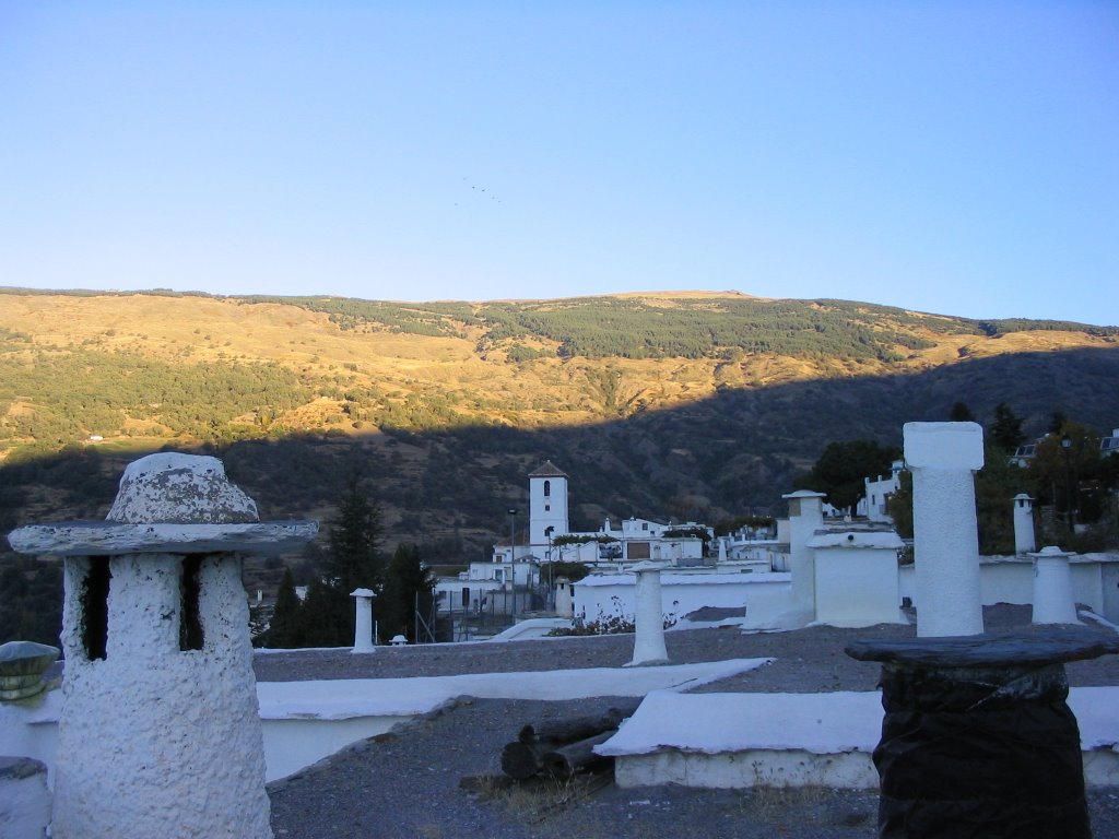
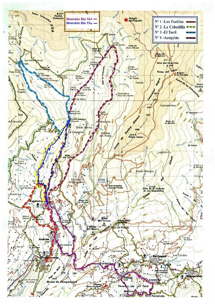
From the ages of Aldeire (excellent natural lookout Poqueira Gorge and these peaks of Sierra Nevada) of this town of Capileira, we start again today and the four direction of the Cebadilla (1,540 m.), a small village of Poqueira power plant, which was inaugurated in 1957.
This road, about a kilometer and runs along the left bank of the river Poqueira, we dive down to the final bridge to the Abuchite to climb and by the opposite side, the Barranco de Prado Largo walking in a gentle but continuous climb for about two km away, between old cottages and terraces, up to a farmhouse crowned by a processor of Seville. Mulhacén views from here, offering its close and great south side, are very dramatic sighting if you sharpen a rare sight to Poqueira Refuge, a small script on this great text on the landscape that nature offers.
Capileira about 10 h. in the morning, after breakfast, some coffee with donuts in another typical restaurant of the people to get into the Poqueira Valley, which in its middle and without high mountains, we discover the nakedness of the southern side highest peaks of the Iberian Peninsula.
From the ages of Aldeire (excellent natural lookout Poqueira Gorge and these peaks of Sierra Nevada) of this town of Capileira, we start again today and the four direction of the Cebadilla (1,540 m.), a small village of Poqueira power plant, which was inaugurated in 1957.
This road, about a kilometer and runs along the left bank of the river Poqueira, we dive down to the final bridge to the Abuchite to climb and by the opposite side, the Barranco de Prado Largo walking in a gentle but continuous climb for about two km away, between old cottages and terraces, up to a farmhouse crowned by a processor of Seville. Mulhacén views from here, offering its close and great south side, are very dramatic sighting if you sharpen a rare sight to Poqueira Refuge, a small script on this great text on the landscape that nature offers.
now descend into The Cebadilla for happen before, up a bit and turning to our left on a dirt track along the side of the Power Plant Poqueira which is 1,540 m. altitude, at the confluence of two rivers that illuminate the Poqueira: El Toril and Naute, formed the latter by the waters of rivers Mulhacén, Rio Seco and Veleta. Poqueira river meets the river to reach Trevélez Guadalfeo river that flows between Motril and Salobreña.
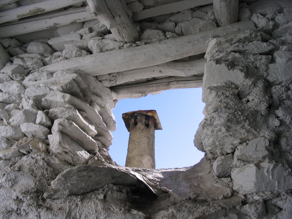
From this place, cool and amazing, we started back across Capileira and the old town of Cebadilla built for the workers involved in the construction of the Power Station. And only follow the first-hand lane in which we are to leave soon after and continue along a nice path (path that runs parallel to a cooling canal) following the signs that mark the milestones, to descend to the final by almost paved trail and that leaves us in the Barrio del Castillo , watching our arrival the curious formation and construction of "terra" houses, characterized by flat roofs, the land covered with gray clay of the place and called "launa"
We also see the huge front Lújar saw that with his 1817 m we closed this long weekend on the Barranco del Poqueira and has managed to short.
Full stop on the 2 hours PM and that after those 4 hours practically walking up and down, collection of moments, some of the photos displayed outside as a sign of "hot" color and smell of these lands, and that after that other typical lunch alpujarreño we look again and so stayed for the next steps ... Thinking and hoping that just the way we take and bring us to discover at each step, as always, something new.
And in those moments of remembrance, I stay and I say goodbye until next time!
*
Route: Circular on both tours.
-Number of participants: 5 / 4
-Difficulty: Medium-Low
-Time: 7 pm / 4h.
-Water, in all the towns
-Number of participants: 5 / 4
-Difficulty: Medium-Low
-Time: 7 pm / 4h.
-Water, in all the towns
0 comments:
Post a Comment